Site Information
Cabin City Campground
 Classification: Campground
Location: Twelvemile Creek Rd.
Latitude: 47.3760°
Longitude: -115.2621°
Elevation: 3202 ft.
Area: West End (St.Regis River Valley)
Season Start: Mid Spring End: Late Summer
Usage: Medium to Heavy
Legal Description: T19N,R29W,sec26 MT
UTMZone: 631193, 5248413
Directions:
(3200') From I-90 take Exit 22 at Henderson, travel east 2.5 miles on Camel's Hump Rd. 2148. Turn left (west) at the Cabin City Campground sign on Twelvemile Creek Rd. 353 for 0.2 mile.
Alternate Directions:
From De Borgia, MT take Interstate 90 east 2.7 miles to Henderson (Exit 22). At stop sign at end of ramp, turn left onto Camel's Hump Rd. and go 1.8 miles to campground sign. Bear left at sign onto Twelvemile Creek Rd. (dirt) and go 0.2 miles to another campground sign. Turn left at sign onto a paved roadway and go 0.6 miles to campground.
Attractions and Comments:
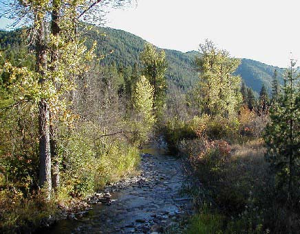
Fishing, self-guided nature trail and interpretive signs.
and beaver dams.
Fees
U.S. Fee Area $7.00/day. Add $3.00/day for extra vehicle. 24 campsites. 5 miles to groceries and gas. Host at site. Cold drinking water. Open Memorial Day through Labor Day.


For more information, contact theSuperior Ranger Station
Narrative:
The elevation is 3,200 ft.
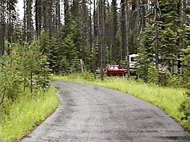
There are two loops - A & B. The campground is thickly wooded with Western Larch, various fir and Ponderosa pines. 12-Mile Creek is nearby. The understory is grass and shrubs providing good seclusion between sites. The variety of trees at different ages give the campground a lush appearance. The campground is convenient to Interstate 90.
SEASONS
Open Seasonal: Yes
Open All Year: No
Seasonal Comment:
Open Memorial Day weekend through Labor Day.
RATE AND MAXIMUM STAY PERMITTED
See: Fees
Rate: $7 per day
Maximum Stay Permitted (days): 14
CAMPGROUND SITE CONFIGURATION
No. RV Sites: 0
No. Tent Sites: 0
No. Combined Sites (Tent or RV): 24
Total Sites: 24
Tent Pads: No
Group Tent Sites: Yes
Open Sites: No
Wooded Sites: Yes
No. Tables on Sites: 24
No. Grilles on Sites:
24
RV INFORMATION
No. Full Hookups (includes waste): 0
No. Water and Electric Only: 0
No. Water Only: 0
No. Electric Only: 0
Group RV Sites: No
No. RV Pull Throughs: 0
Waste Station: No
Potable Water at Waste Station: No
Average Parking Apron Size: 11.5' X 54'
Comments:
The parking aprons are dirt and gravel. The campground can accommodate most any size RV. There is a RV waste station at the Quartz Flat campground (National Forest) 10.1 miles east of
Superior, MT on Interstate 90 (at the rest area) - fee $2.
FACILITIES
Vaults: Yes
Flush Toilets: No
Hot Showers: No
Wheelchair Friendly Toilets: Yes
Public Phone: No
Playground: No
No. Water Spigots: 4
No. Threaded: 0
Comments:
Wheelchair friendly vault in Loop A only.
WATER SPORTS - None
HIKING
Hiking: Yes
Comments:
Cabin City Interpretive Trail (loop & foot only) - 0.75 miles
FISHING
Fishing:
Yes
Comments:
Rainbow and Cutthroat Trout
Facilities: Campsites, Drinking water, Fishing,
| |
| |
Trail Map:
|
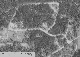
Photo:
|
The 7.5 minute series USGS topographic maps for that area
| ? | ? | ? |
| Haugan |
De Borgia North SE | Penrose Peak |
| McGee Peak | De Borgia South | Boyd Mountain |
Switch to TerraServer - Topo Map
Switch to TerraServer - Aerial Photo(If Avail.)
Switch to Maptech MapServer
Switch to TopoZone MapServer
Switch to TopoWest Quad MapServer